Blaricum from above
Below is a selection of drone footage. Several videos are also available on this page.
These are prominent places in the village or unique, often old, objects such as historic farms.
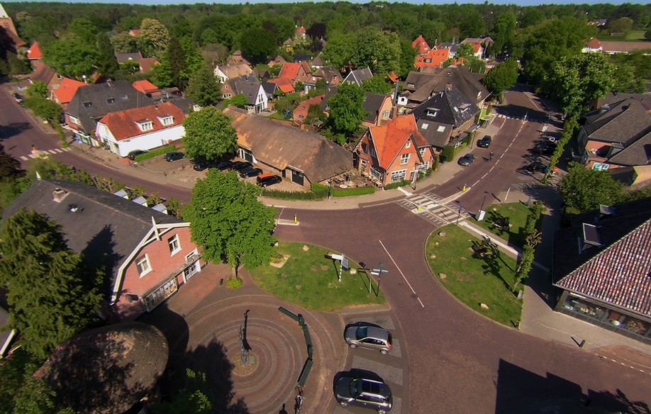
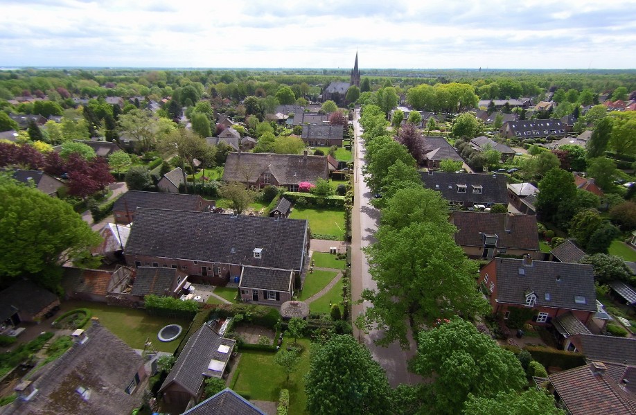
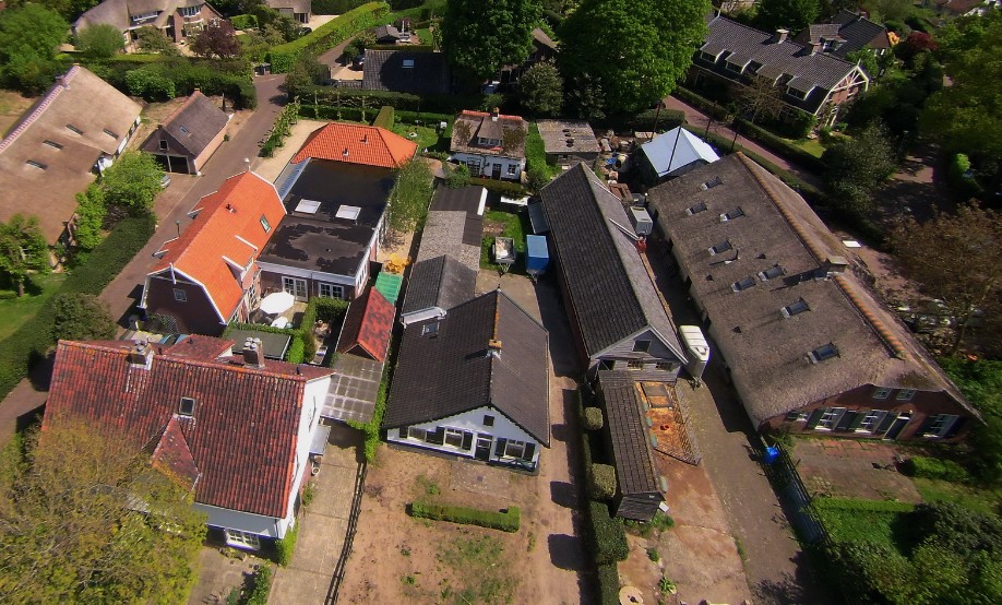
The center of Blaricum. The next photograph zooms in on the center.
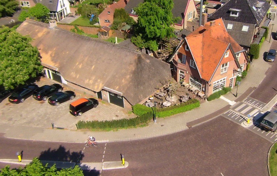
The former farmhouse, Torenlaan 2, dates from 1698. The house next door houses the restaurant da Bruno, which dates from 1916.
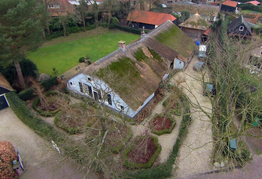
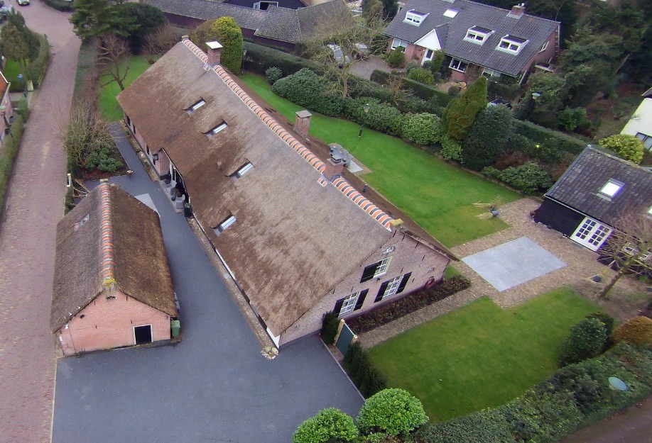
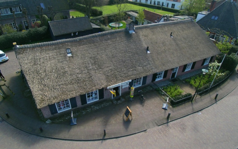
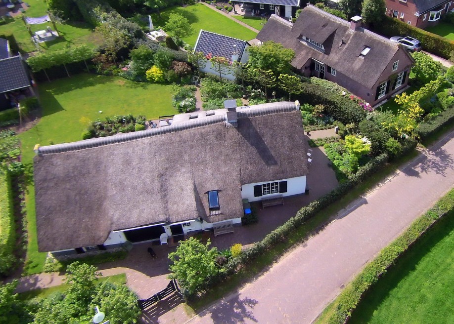
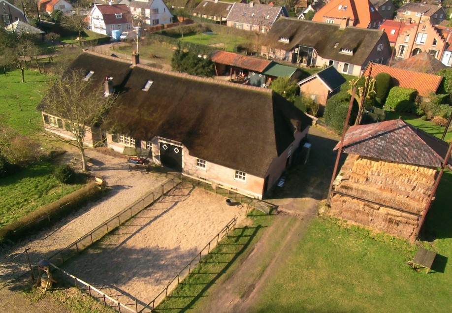
A little further towards Huizen is a very old former farmhouse at Achterom 7.
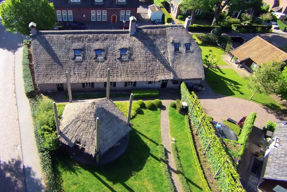
This building did house the Indonesian restaurant Merpatis.
Both the building and the haystack are national monuments. The building dates from 1657.
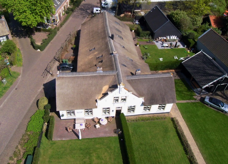
The Reformed Church is located approximately 200 meters back on Torenlaan.
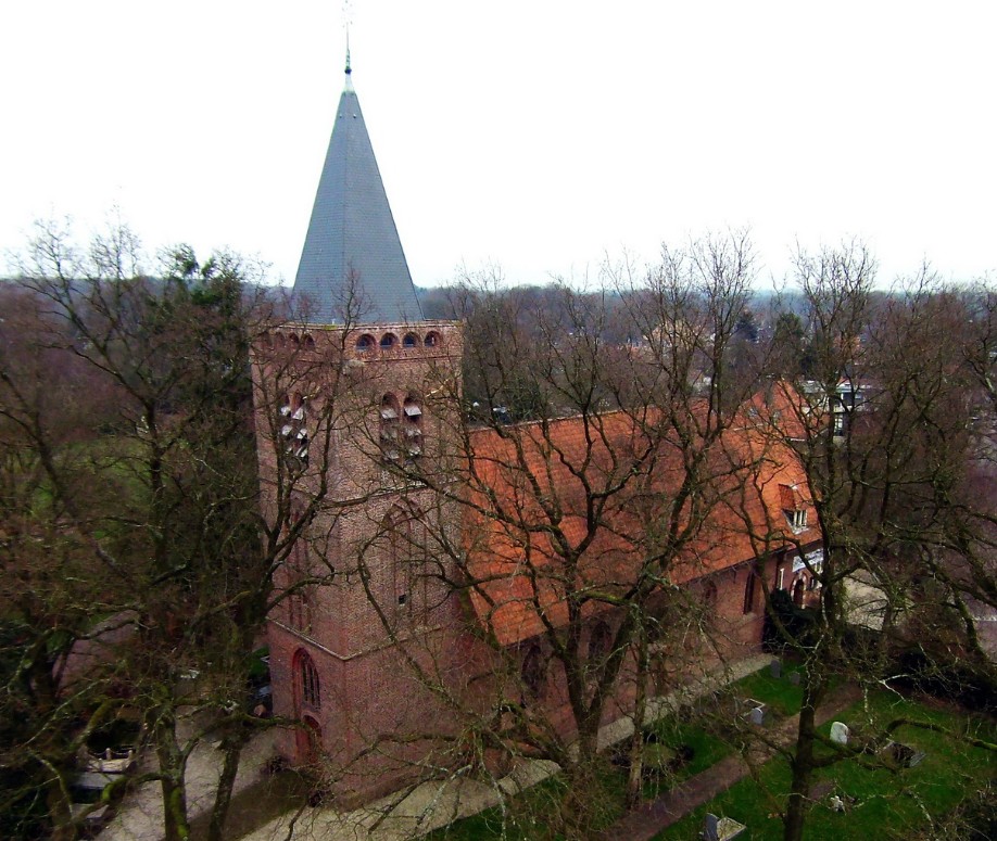
This church probably dates from 1512, making it the oldest building in Blaricum (this date is indicated on the oldest clock).
The land registry records the year 1696; that year, a major fire severely damaged the church, which was subsequently restored.
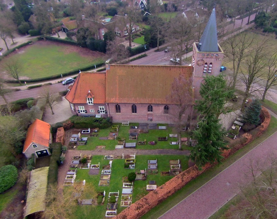
In 1934, the consistory room was added as part of a restorationen restauratie de consistoriekamer aangebouwd
View across Kerklaan to the Roman Catholic Church.
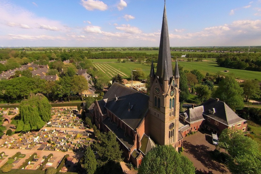
The St. Vitus Church, which was consecrated in 1871 and partly renovated in 1937
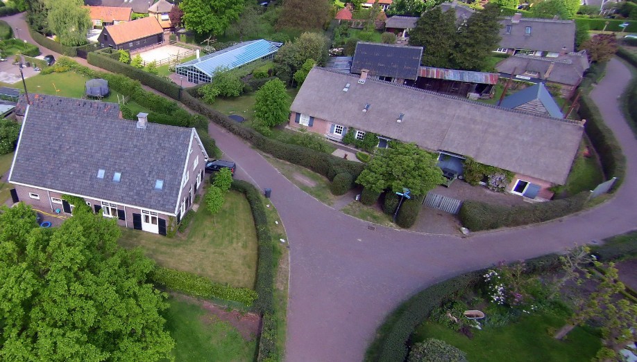
The oldest farm in Blaricum. Located at Langeweg 9, it dates back to 1620.
The farm at Langeweg 5 dates back to 1900.
The farm at Langeweg 3 dates back to 1900.
The farm in the lower left corner of the photo is located at Meentweg 5 and dates from 1900. The building on the right is located at Langeweg 7 and dates from 1920.
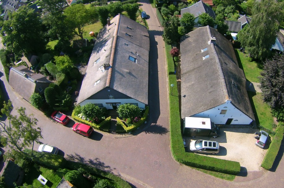
The farm at Langeweg 5 is shown again in the top center of the photo.
At the bottom right of the photo is the house at Langeweg 11 from 1908. On the left, across the street, is the former farm at Meentweg 7 from 1909.
From left to right, buildings on Burg. Heerschopweg, numbers 4, 6, and 8, date from 1920, 1880, and 1932, respectively.
Dorpsstraat: the Blaricum Bookstore at no. 12 and Dorpsstraat no. 10 both from 1785
Dorpsstraat 15 and Brinklaan 2, 2A and 4. They form a cross-shaped farm dating back to 1628.
The farm at Gebr. Dooijewaardweg 1+3, which dates back to 1800.
The former farm at Fransepad 26 dates back to 1840. Next to it at number 22 is a house dating back to 1921.
Binnenweg 8 and 7, both from 1900.
The farm on the right in the photo is located at Capittenweg 2 and dates back to 1780. The farm next to it consists of two parts: Kerkpad 2 and Capittenweg 1. According to the land registry, they date back to 1958 and 1936 respectively; very likely they are older, but these dates are probably the result of a restoration.
In the foreground the farm at Eemnesserweg 2 from 1890 and opposite that Gallery de Vlierhoeve at Fransepad 1 from 1840
The farm at Angerechtsweg 11, also known as the "Aspergeboerderij" (Asparagus Farm), dates from 1900.
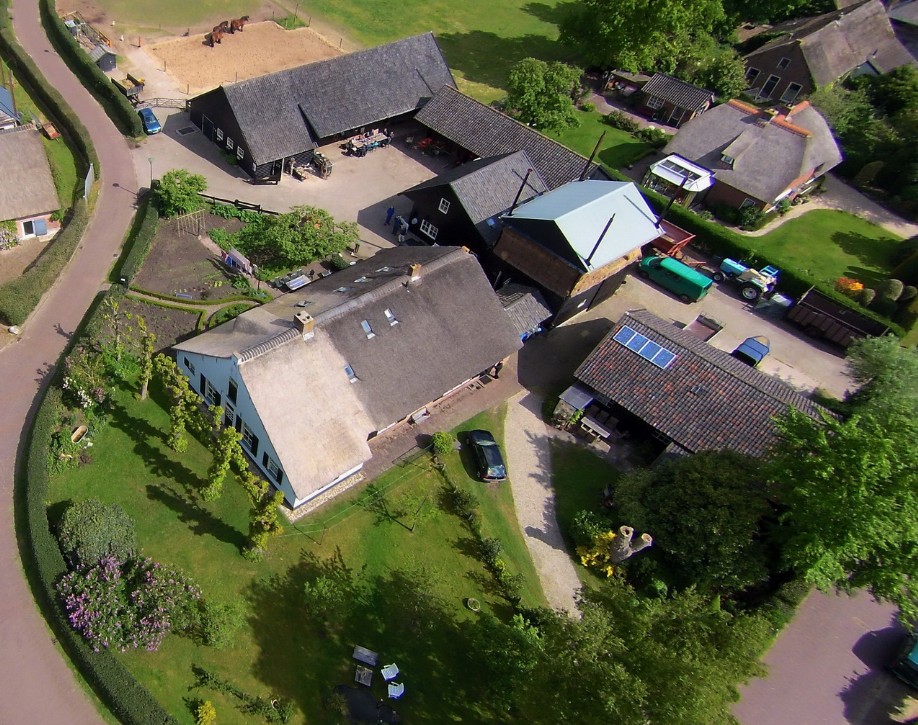
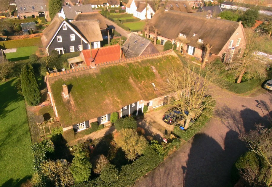
An older farm is shown in the background and in the next photograph
This farm is located at Meentweg 6 and dates back to 1841
This farm is located at Zwaluwenweg 2b and dates back to 1800.
Below are some videos.
We fly from the Roman Catholic Church over Kerklaan, Fransepad, Binnenweg, and Angerechtsweg.
Flight over the Meentweg from St. Josephweg, Langeweg, Naarderstraat and Piepersweg.
Flight from the Kruiskuil, over Fransepad, Eemnesserweg, Raadhuisstraat, Torenlaan, Dorpsstraat and Brinklaan back again.
Short flight at Table Mountain near the Tafelberg (hill)
Renovations took place in 2019, including moving the stairs to the other side.
Below is a video taken in November 2023.
See the chapter on Tafelberg for more information.
Flight over 't Harde.