The Tafelberg
The Tafelberg (hill) stands in an uneven terrain formed during the penultimate ice age (around 130,000 years ago). It is not a natural hill, but rather a man-made structure.
Until the 17th century it was called Kooltjesberg (Coal Mountain) because a coal fire was lit there. This served as a beacon for sailors on the Zuiderzee (at that time sea but later a lake due to the Afsluitdijk, a dike between the provinces Noord-Holland and Friesland. In the 17th century, a stone orientation table was placed on top, giving it the name Tafelberg (literal Table Mountain.)
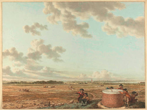
The presumably oldest image of Tafelberg comes from the Schoemaker Atlas. This is a collection of topographical drawings with descriptions of towns created and collected by Andries Schoemaker (1660-1735). Below is a drawing from 1727.

The stone table on top of the mountain is clearly visible
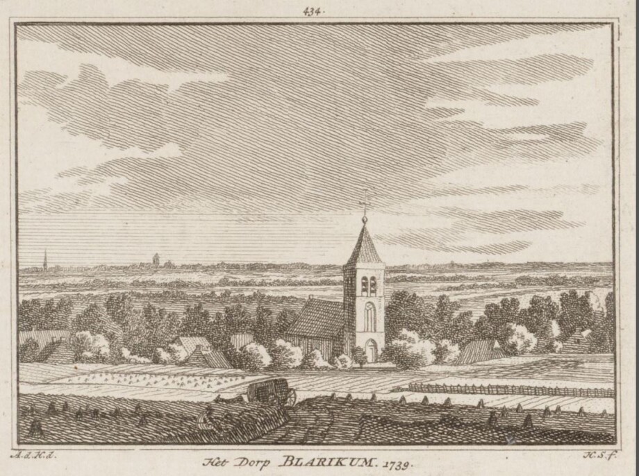
The view from Tafelberg on the village of Blaricum in 1739
ex: Het Verheerlijkt Nederland of Kabinet van hedendaagsche gezigten van den dorpen enz. in de Vereenigde Nederlanden, Deel VI, Amsterdam 1757 (The Glorified Netherlands or Cabinet of Contemporary Views of Villages, Etc., in the United Netherlands, Volume VI, Amsterdam 1757)
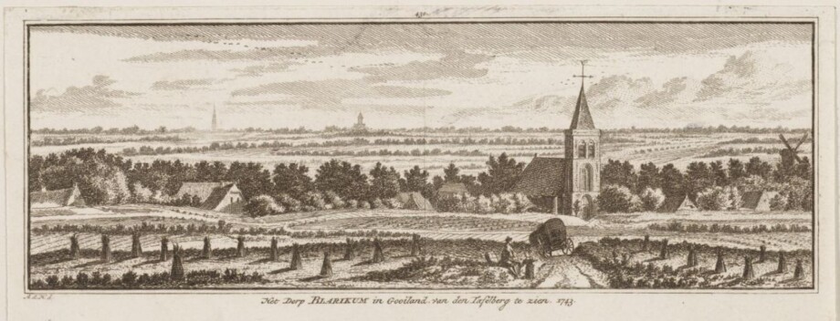
The view from the Tafelberg on the village of Blaricum in 1743
Provincial Atlas Collection, North Holland Archives. Inventory number NL-HlmNHA_359_0606
The Blaricum windmill is visible on the far right of the image.
Watercolor by the artist Jacob Cats, circa 1795
Provincial Atlas Collection, North Holland Archives. Inventory number NL-HlmNHA_359
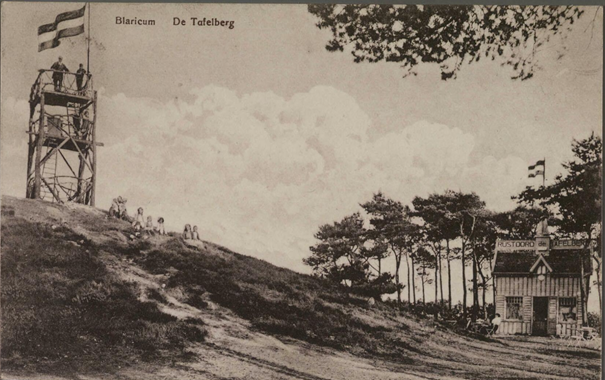
Around 1900 the Tafelberg became more of a tourist attraction because the Gooi steam tram improved access to the area and the population of the municipalities in 't Gooi grew rapidly. A kiosk served the many day-trippers near the hill, which at the time was approximately 20 meters high. Below is a postcard from that period, which did not yet feature a lookout tower.
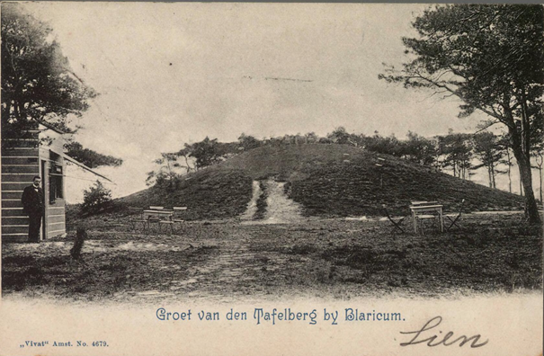
Provincial Atlas Collection, North Holland Archives. Inventory number NL-HlmNHA_162_2476_348. Dating: 1899-1904
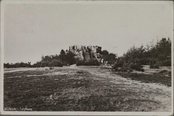
Below is a postcard, probably from the period 1910-1920.
Provincial Atlas Collection, North Holland Archives. Inventory number NL-HlmNHA_162_2476_354
Table Mountain at the time, with a primitive wooden lookout tower and the "Rustoord de Tafelberg" (Table Mountain Rest Area) at its foot.
In 1921, the municipal council of Blaricum decided to connect the municipality to the provincial water supply network. To maintain pressure on the pipes, water would have to be drawn from a higher reservoir. Table Mountain was chosen as the location.
At the time, the Tafelberg was owned by the Stad en Lande van Gooiland association. The province succeeded in obtaining a 75-year lease on it. The water reservoir on it was made of reinforced concrete and had a usable capacity of 600 m³. It was shaped like a dodecagonal prism. The soil around the reservoir was arranged in such a way that a staircase created an accessible viewing platform. This intervention raised the Tafelberg by several meters. The planting was as natural as possible, so many visitors didn't realise there was 600 cubic meters of drinking water beneath their feet. From a height of 28 meters, visitors could enjoy the panoramic view.
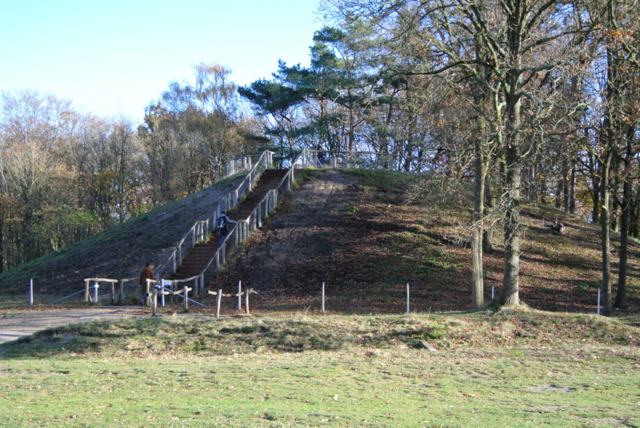
The raised hill on the border of Blaricum and Huizen, named Tafelberg after its conversion into a water reservoir in 1922, still bears the pumping station casings. The stairs are on the east side of the mound.
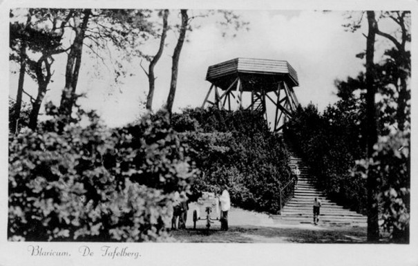
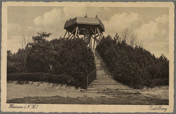
In 1934, a new observation tower designed by Wouter Hamdorff was erected on Tafelberg. The hill was now owned by the newly established Gooi Nature Reserve. The tower was a spacious hexagonal structure approximately 6 meters high. Its total height above sea level was approximately 42 meters. A spiral staircase led to a platform 10 meters in diameter, offering a magnificent view of the Gooi region.
Provincial Atlas Collection, North Holland Archives. Inventory number NL-HlmNHA_162_2476_353
Tafelberg with the viewing platform built in 1934
Below is another postcard from around 1938
Provincial Atlas Collection, North Holland Archives. Inventory number NL-HlmNHA_162_2531_0030
Unfortunately, this tower was only in service for a short time. During the Second World War, it fell into disrepair, and in 1947, the lookout tower was closed by order of the municipality of Blaricum and later removed. At that time, the Tafelberg elevation was 36.4 meters above sea level.
In the 1980s, the concrete foundations were removed. In 1988, the Goois Nature Reserve undertook the renovation. The Tafelberg was fitted with a wooden gate, replacing the old iron gate. The staircase was replaced with 34 steps. The vegetation was pruned back. A stone table measuring 1.2 by 2 meters was installed, but over the years, it has been vandalized and destroyed.
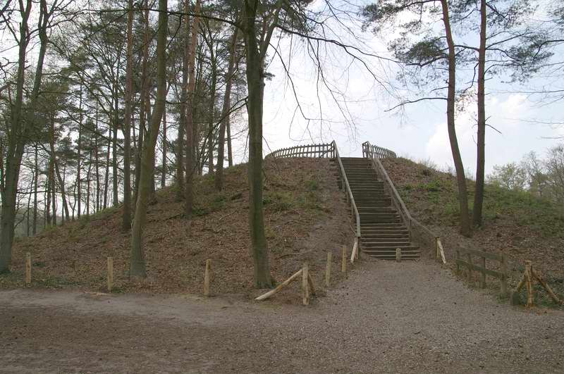
Tafelberg in 2008. The stairs are still on the east side of the hill.
In 2019, a renovation was decided upon. It received a new steel staircase, which was placed exactly on the municipal border of Huizen and Blaricum, but now on the west side of the hill.
Caps run across the center of the 47 steps, marking the boundary. At the highest point, a 1,000-kilogram piece of natural stone was placed, marking the elevation of 39.2 meters above sea level. The cardinal points are also visible on this capstone.
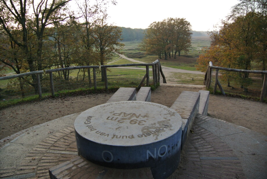
On February 14, 2020, the new viewpoint on the Tafelberg was officially opened by GNR director Karin Kos and Alderman Verbeek of the municipality of Huizen and Alderman Knoop of the municipality of Blaricum.